Monday, March 4, 2013

Summit # 71 - Big Cedar Mountain, GA (Preacher Rock)


     This past Saturday night I stepped outside to take the dog out and instantly, my sunday morning was planned. It was (just barely) snowing. Like a kid on Christmas, I headed inside and turned on my electric blanket picked a peak to hike in the mountains, where I knew there would be a nice dusting by morning.
     I can remember a time in my life when I would often make fun of southerners for freaking out about the snow. After all, I was born in Pennsylvania, where its seen by most as a seasonal nuisance (at best). And while I still chuckle at the sight of people emptying grocery store shelves at the forecast of a chance of flurries, I must admit that I have turned the corner on being excited about snow. (The fact that we never get enough to require shoveling may have something to do with that). After all, nothing beats hiking in the mountains with a (light) dusting of the white stuff. Hopefully I'm not developing a southern drawl too.
     With that admission out of the way, I must urge everyone to check out Preacher Rock atop Big Cedar Mountain in the Chattahoochee National Forest here in Georgia. It's close (1.5 hours from Atlanta) and accessible (3 mile round trip hike on the AT, around 600 feet of elevation gain). And the pictures speak for themselves - it's beautiful (especially with just enough snow to cover everything - that's how we do it here in the south).


Thursday, February 21, 2013

Summit # 59 and # 60 - Wildcat Mtn. and Cowrock Mtn, GA


I woke early this morning (aided by 2 hungry cats and a dog), took a quick look at the weather forecast for the next few days (more rain), and decided that I just had to head to the mountains. After all, it's February and I'm in the pool business - It won't be long before things are far too busy to blow off work mid-week for a carefree trip up to my Appalachian playground. After consulting with my guide (aka Google) I picked a spot on the Appalachian Trail just north of Cleveland, GA that was perfect. We picked up the AT at Hogpen Gap and climbed over Wildcat Mountain and Cowrock Mountain, both of which had great views on this sunny, clear day. The skyline of Atlanta was even visible, over 100 miles to the south (It's amazing how quiet and peaceful a city with millions of people can look from a silent, faraway mountain top). We hung out for a bit on the summit of Cowrock before backtracking to the truck and heading home.

we had a bit of snow left over from a late winter storm for the climb up
Wildcat Mtn.

view of Cowrock Mtn. from the Wildcat summit. The large open "table" where we would later stop are just visible near the summit.


start of the climb up Cowrock Mtn. from Tesnatee Gap
southern Appalachian "glacier"
the AT near the Cowrock summit

view from the Cowrock Mtn. summit. Wildcat Mtn. on the far left. 


Sunday, February 10, 2013

Summit # 43 - Tray Mountain, GA


Tray Mountain, GA - Elev. 4,430 ft.

I woke up early this morning and took a trip up to Tray Mountain, the seventh highest peak in Georgia. It was a balmy 50 degrees when I left my house in Marietta, but by the time I had reached the parking area at Tray Gap the temperature had dropped to near-freezing and the wind had picked up quite a bit. Luckily my laziness from the night before paid off as I had an extra jacket in the truck. Jax and I climbed up the AT to the peak in no time and were rewarded with clear views of the Nantahalas to the north and the rest of the North Georgia mountains to the south. We hung out for a bit and headed back, Jax sleeping in the backseat and me debating where to stop and eat in the front (a pizza place in nearby Helen, GA won that debate). 

the view south from the Tray Mountain summit


North Carolina mountains to the north

the AT switchbacks its way down the mountain
obligatory dog picture


headwaters of the nearby Chattahoochee River


Thursday, February 7, 2013

Thank You!

Just wanted to send a quick note to thank everyone that has been so supportive of my little adventure up to this point. I'm proud to announce that I have already gone past my $500 goal for the year and it's only the first week in February! Thank you so much to everyone. I guess the pressure is on me now to keep it up. (On a side note I did see a surgeon today about a hernia I have developed. It looks like surgery can hold off for now but that could change at any time - Keep your fingers crossed! Luckily the recommended recovery activity is walking, so the surgeon can't be too mad at me if I hike up a mountain, right?) I have gone ahead and raised my goal for the year to $1,500 and hope to have to raise it again. Also I'm working on some t-shirts or maybe some other fun giveaways if those work out so stay tuned. I'm still planning to get to as many mountains as I can, including some in the Smokies and Shenandoah National Park in the next few months as well as many others here in the southeast and will be blogging (that still feels weird to say) when I do so. If anyone has any mountains or great hikes in mind or wants to join me, just let me know - I'm up for anything. Again, thanks so much to everyone for your support. 
-R.E.


Sunday, January 27, 2013

Summit # 27 - Blood Mountain, GA


I headed up to one of Georgia's most famous peaks this morning and enjoyed 5 mile out and back to the summit of Blood Mountain. At 4,458 feet it is the highest point on the Georgia section of the Appalachian Trail and the sixth highest peak in the state. I was excited to have a clear, cold day to take some pictures at the summit with my Nikon DSLR until I reached the top and realized that I had foolishly failed to charge the battery before leaving home. Hence the grainy, blurry cell phone pictures you will see below. They will give you some idea of how beautiful it is on the summit on a clear day anyways. On the bright side I have an excuse to head back up there with a fully charged camera (not that I needed one). I had my first good fall of the year today - a tumbling, thundering, arms and legs flailing embarassment of a fall. My first reaction was to be sure that I didn't manage to actually injure myself (I didn't, if you don't count my ego) and my second was to look around and see if there was anyone around that had seen my glorious tumble (thankfully there wasn't). I thought for a second my dog Jax may have been laughing but I figured the secret was good with him. Of course I'm blabbering about it on the internet so I guess it's not a secret anyways.


The AT winds it's way up Blood Mtn.

one of many great views from the summit

Blood Mountain shelter, built in 1933


I got a nice chuckle from this
One of us got a nice nap on the way home

Monday, January 21, 2013

Summit # 20 - Medlin Mountain, SC

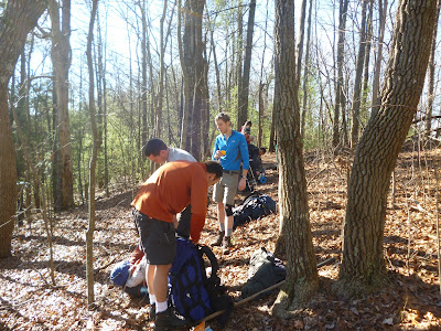
A few buddies and I spent the weekend hiking the 20 mile Foothills/Fork Mountain/Chattooga Loop located in the Ellicott Rock Wilderness along the Chattooga River. In the process we climbed Medlin Mountain, which at 3,143 ft. is the 12th highest peak in South Carolina. This is our 12th consecutive MLK Weekend backpacking trip and over the years we have seen a little bit of everything - icy mountain roads, car accidents, sub-zero temperatures, "interesting" locals and all sorts of wildlife. One year we even hiked 9 miles in the wrong direction - I'll save that story for a future blog. This year we had a great trip and my only regret is forgetting to take a picture of our table at Wendy's afterwards. My buddy Casey shot some video with his GoPro (an awesome gadget that I now must have) so I'll have some videos to post at some point but for now here's some pictures from our trip:

King Creek Falls


Our camp on Night 1 along the Chattooga


start of the hike up Medlin Mountain
heavily wooded summit of Medlin Mountain
here we are probably talking about food

entering the Ellicott Rock Wilderness
camp Night 2
thanks to my buddy Joe (www.suburbanwino.com) for the awesome travel wine
fire picture
one of several stream crossings made difficult because of recent heavy rains

finished up back along the thundering Chattooga